Saturday 31 December 2011

Bandipur

Thursday 22 December: From Kathmandu's tourist bus stand in Kantipath it's a 300 Rupee, five-hour, trip to Dumre then a jeep, heavily-laden with 18 passengers, for the half-hour ride up to the village of Bandipur. I'm on my way to Pokhara lakeside for the festive season but have decided to break my journey in this pretty traffic-free village.
I'm here not just to see the Bandipur but also to climb, through terraced mustard fields, to the summit of the flat-topped hill of Tundikhel for a stunning panorama of the Annapurna range.
Photos of and from Bandipur.

Kathmandu

Wednesday 21 December: Back in the noise and pollution of the capital I'm staying in Century Lodge which, from the outside, looks like a bomb has hit it. Inside though I have a sunny room with a small balcony adjacent to the 'hot' shower and western loo. The price has increased to 300 Rupees a night (about £3). I've been using the lodge as a base to explore the UNESCO World Heritage Sites of the Kathmandu valley.
I like Century Lodge and Kumari's cafe out in the front yard which provides a decent breakfast and a good dhall bhatt set dinner in the evening. I have at hand my kilo of Yak cheese (actually it's Nak cheese as the Yak is the male, difficult trick) and a handy supply of Mustang apple 'brandy' (cider) for supper. Better fare is available in Thamel like the Nepali set thali with tongba in Hot Plate restaurant and the steak menu in K-Too where I spend my final evening.
A few photos of Kathmandu plus photos from April and May 2010.

Friday 30 December 2011

Swayambhu

Monday 19 December: There's a National strike today so, with no buses or taxis and few motorbikes on the roads, it's a pleasant and quiet stroll an hour or so west to the Buddhist hilltop stupa in Swayambhu. Passing colourful chortons and Buddha statues along the way, it's a steep climb up to the summit. Troops of Monkeys entertain pilgrims along the route swinging and hanging from the railings just waiting for the opportunity to snatch food or water bottles from the unwary tourist. Above the glittering gold stupa hundreds of Steppe Eagles soar, circle and swoop adding to the impromptu entertainment. The view over Kathmandu is a polluted haze despite today's lack of traffic.
Back at street level there's a pleasant prayer-wheel lined walk to one of the largest mani wheels I've seen, hidden in it's own little colourfully-decorated temple.
Photos of Swayambhu.

Thursday 29 December 2011

Bhaktapur

Sunday 18 December: Further north and just round the corner from Ratna Park is the stand where buses depart for the one-hour journey to Bhaktapur, the third Medieval city in the Kathmandu Valley. The least impressive and most expensive (US$12) of the three sites, it's dominated by the five-tiered Nyatapole Temple which, at 100ft high, is the tallest in Nepal. The pairs of temple guardians are said to get more fearsome and powerful as you climb the steps: Rajput wrestlers armed with bludgeons, Elephants, Lions, beaked and horned griffons and finally two Hindu Goddesses. Just south is a labyrinth of alleys leading to Potters' Square, where carefully crafted clay-ware is drying in the hot sun.
To the north is Durbar Square with King Bhupatindra Malla's Column and the stone Vatsala Durga Temple of similar South Indian design to those at Patan, but the wonderful gilded-metal Golden Gate is unique to Bhaktapur.
Photos of Bhaktapur.

Patan

Saturday 17 December: There are three ancient cities in the Kathmandu Valley, Kathmandu, Patan and Bhaktapur, each with it's own distinctive showcase Durbar Square. Throughout history each successive city builder has not only tried to outdo his predecessor but has also also tried to outdo his neighbouring king. I'm staying in Kathmandu's Durbur Square and Patan is only short stroll south, so that's where I'm headed today.
Once over the non-too-clean Babmati River the suburbs get prettier and, passing a large water-tank, several courtyards open up to reveal an array of Hindu icons and temples. One courtyard accommodates the Golden Temple with fierce stone guardians protecting the gleaming gilded Buddhist metalwork. A small alley leads to the five-storey Kumbeshwar Temple where worshipers poke and stir wood-fires in his honour.
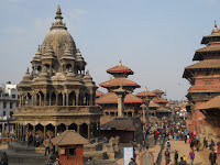
A little further south is Patan's bustling temple complex of Durbar Square. Krishna Mandir is the most impressive, not least because, rather than being built of brick and wood, it's intricately carved from a single piece of stone. Overlooking the temple, with his back to the Royal Palace (now a cafe-museum) is King Yoganarendra Malla's Column topped by his brass statue. Legend has it that if the small brass Sparrow perched above his head flies off the king will return. But local wags have it that if this happens the two large stone Elephants (one crushing a man), fronting the two-tiered Vishwanath Temple, will wander down to the water-conduit for a drink.
Photos of Patan.

Wednesday 28 December 2011

Boudhanath

Thursday 15 December: Now based in Kathmandu, I'm exploring the UNESCO World Heritage Sites in the area that I didn't have time to see during my short visit in 2009. The first one is a real corker and it's only a half-hour bus ride from the chaotic old bus station, at Rana Park, opposite the tourist office.
An important place of Buddhist pilgrimage, the great stupa of Boudhanath is where traders and travellers sought blessing for safe passage over the mountain passes to Tibet and gave thanks upon their safe return. I add my thanks.
Joining the other pilgrims I take several clockwise turns or koras around the whitewashed stupa and spin many of the multitude of mani or prayer wheels as I go. A double lotus flower is subtly depicted in saffron water around the base of the dome and, above the eyes of Buddha, strings of colourful prayer flags adorn the jeweled and gold embossed crown. A store for sacred energy? I'm not sure, but it is certainly a very special and heart-warming place.
On my way back to Kathmandu's Durbar Square, I stumble across Kasthamandap, the city's largest supermarket, where I'm able to stock up with some of the material essentials of travelling life - Shiraz red wine, Mustang apple brandy and a new pair of 'Nike' running shoes which, at 1,449 Rupees (around £14), seem like a bargain. I wonder how long they'll last . . . certainly longer than the drinks.
Photos of Boudhanath.

Everest Walk Out

Sunday 4 (day 20): Lobuche to Tengboche. A warm early morning start and a late breakfast at Duglha before making Pheriche for lunch where I'm forced, by the icy heat-sapping wind that howls up the valley, to add several layers of clothing. Moving fast now, at lower altitude, it's like walking on air. I've caught up with David and Kate and, from our tea and apple pie stop, there are good views back to the soaring peak of Ama Dablam. 'Thyangboche' Guesthouse (recommended) is our warm and welcoming overnight stop in Tengboche.
Monday 5 (day 21): Tengboche to Namche Bazaar.
In the morning we explore Tengboche's Monastery, made famous for blessings endowed on Everest expeditions and there are fine views over the cloudy valley where it's all downhill to Namche. Saying goodbye to the Californians I opt for the Khumba Lodge this time. It's where ex-US President Carter stayed when he visited. I'm sure he had a better room than the one I'm in, but the piping hot shower is wonderful.
Wednesday 7 (day 23): After a rest day Namache it's downhill again but, paying too little attention to my route, I'm going uphill. I've taken a wrong turn and find myself all the way up in Lukla. So as night falls, and having to use a head torch, it's a relief to drop down to the Everest Trail Lodge in Surkhe.
Thursday 8 (day 24): Surkhe to Jubling. A long day down past painted stone chortons and pretty homes, Gorkhali Lodge in Jubling has a comfortable room overlooking the village centre.
Friday 9 (day 25): Jubling to Junbesi. Another long day and it's dark when I happily arrive back at Ang Chhokpa's Lodge (recommended) for more of the best dhall bhat of the trek.
Saturday 10 (day 26): Junbesi to Kinja. Early morning up then a long downhill stretch back Kinja and New Everest Guesthouse, once again, arriving after dark.
Sunday 11 (day 27): Kinja to Shivalaya. A shorter day and in daylight I arrive at River Guesthouse next to a suspension bridge on the east bank of the Khimti Khola.
Monday 12 (day 28): Shivalaya to Jiri. Mostly downhill it's a short day down to the Sherpa Guesthouse (a better choice than before) in Jiri to buy a kilo of, so called, Yak cheese and arrange a microbus (minibus) back to Kathmandu. Great trip.
Photos of Everest Walk Out back to Jiri.

Monday 26 December 2011

Roof of the World

Friday 2 December (day 18): Dzonglha to Lobuche (4,930m) (16,269ft). Down one valley then up another one and I'm back on the Everest Base Camp route which runs alongside Khumba Glacier to the pleasant Up in The Clouds Lodge in Lobuche.
Saturday 3 (day 19): Lobuche to Gorak Shep 5,160m (17,028ft), on to Kala Patthar 5,550m (18,315ft) and back to Lobuche. This is a long day gently uphill at first, where I meet David and Kate again who are heading down, I'm sure we'll meet up again. For me it's onward and up over Changri Nup Glacier before arriving at Gorak Shep's Buddha Lodge for lunch. In the afternoon it's two hours steeply up to the summit of Kala Patthar for spectacular views of Everest hiding behind the far more spectacular shoulder of Nuptse. The icy western flank of Nuptse is alive with the loud cracking of avalanches, most small, one quite large. Clouds of white snow cascade down the mountainside. This is fantastic, almost close enough to touch.
I'm breathing hard when I reach the flag-draped peak of Kala Patthar. So much so that I'm nearly caught up by two teenage Aussie girls, daughters of the couple who waded through the glacial meltwater stream.
The views back down to the moaning and creaking Khumbu Glacier and Gorak Shep are almost surreal. Great day. It's dark when I get back to Up in the Clouds Lodge.
I've decided not to head to Everest Base Camp as there's not much to see - at this time of the year all that remains of the Everest mountaineering expeditions is their trash.
Roof of the World photos.

Saturday 24 December 2011

Gokyo Sacred Lakes and Cho La Pass

Wednesday 23 November (day 9): Rather than going directly towards Everest I've decided to take the scenic route via Gokya and Cho La Pass then return to Namche by the Everest walk-in route, so I part company with Matt and Lorraine who, short of time, are taking the more direct route. Due to the altitude gain it's a short up and down day from Namche, via Mong La Pass 3,975m (13,117ft), to the basic Gozumba Guest House in Phortse Thenga.
Thursday 24 (day 10): Phortse Thenga to Dhole 4,090m (13,497ft). Another short but all uphill day to the pleasant Yeti Inn in Dhole where I have time to finish Chris Bonnington's 1976 book Everest the Hard Way.
The
owner is friendly Sherpa who tells us that his father, who had climbed Everest several times, threw him out of the family home when he refused to follow in his footsteps (most Sherpas say that they climb so that their son's don't have to). He does have on display, together with some of his Father's vintage mountaineering gear, a treasured photograph of himself, as a young man, with Sir Edmund Hillary. Nice man who believes in Yetis the same way I believe in the Loch Ness monster. Here I meet David and Kate, a hippy father and his daughter from California, a happy pair.
Friday 25 (day 11): Dhole to Machherma 4,410m (14,553ft). A short uphill day to the warmth of Yeti Lodge in Machherma where a Yak train is tied up for the night.
Saturday 26 (day 12): Machherma to Gokyo 4,750m (15,675ft). Another uphill day to Gokyo where, after lunch, I climb Gokyo Ri which at 5,360m (17,688ft) is around four times higher than Ben Nevis. It's an exhausting experience and I'm forced to stop frequently to take deep breaths. The summit's only other inhabitants are a pair of finch-like birds, Alpine Accentors, who are undisturbed by my presence but the real reward is the breathtaking views over to the Everest range and downhill to Gokyo's pretty lake.
In the evening, for warmth, we huddle round Namaste Lodge's dung-burning stove and later I dream that I'm struggling for breath, drowning in a tank of air with a brain-splitting headache. Slowly I realise it's not a dream, I'm awake. I sit up in bed for several hours taking deep breaths. If this persists tomorrow I'll need to descend.
Sunday 27 (day 13): Gokyo. I spend an acclimatisation day reading the Dalai Lama's book, The Art of Happiness, I feel not only rested but more content.
Monday 28 (day 14): Gokyo. Feeling better today I hike north along Ngozumba Glacier to Goyko's 5th lake and up to Scoundrel's Viewpoint, 5,000m (16,500ft), for spectacular vistas of Cho Oyu's icy wall and the fang-like Cholo. The creaking glacier and my footsteps are ignored by a flock of Partridge.
Tuesday 29 (day 15): Goyko. I return to the summit of Gokyo Ri to catch Everest in the sunset - it's spectacular but there's a dark and chilly descent back to the comfort of Namaste Lodge's dung-fired stove.
Wednesday 30 (day 16): Gokyo to Thangnag 4,700m (15,510ft). A short but fascinating day I head east across the creaking and cracking Ngozumbo Glacier (I can't believe how loud it is) where amidst the grey morraine little Pika or Mouse-hares dart between the boulders.
An Austrailian couple and their two daughters, who I meet later, tell me that when their guide took an old path across the glacier they were obliged to wade, chest deep, across a melt-water stream wearing just underware and their socks for grip. I navigate my way across easily. Local guides can be a bit hit and miss.
Thursday 1 December (day 17): Thangnag to Dzonglha over Cho La Pass 5,368m (17,714ft). A long tough day which, with hindsight, would have been better tackled with an ice axe and a pack lunch. A steep breathless scramble over jagged rocks leads to Cho La's icy saddle where a slippery hard-ice path crosses an high-altitude glacier before continuing steeply down towards an open valley and Dzonglha's fairly cheerless Green Valley Lodge. Finally, much needed food, I've made it.
Photos of Gokyo Lakes and Cho La Pass.

Thursday 15 December 2011

Everest Walk In: Jiri to Namche Bazaar

There is now an airstrip at Lukla, where package tourists are air-freighted straight to high altitude, but I've chosen the original mountaineer's walk-in route from Juri to Everest Base Camp both for nostalgic reasons and to aid my fitness and acclimatisation process. Tuesday 15 November (day 1): Juri to Bhandhar. Departing Juri's Cherdung Lodge at 7:30am it's a muddy uphill hike through the chilly mist to Shivalaya. Stopping for a dhall bhatt (lentil broth with rice and lightly spiced vegetable curry) lunch here I meet up with Matt and Lorraine, from London, who are on a six-month work-gap trip to Nepal, Sri Lanka, India and the Philippines. We are persuaded to buy a, probably unnecessary, 2,000 Rupee (about £20) Gaurishankar Conservation Area Permit (we are only just clipping the edge) before logging-in our TIMS cards at the police post. By mid-afternoon, after a cold and misty climb over the 2,705m (8,926ft) Deuralia Pass (about twice the height of Ben Nevis), we drop down to Bhandar and the comfortable pink and blue Ang Dawa Lodge, our home for the night.
Wednesday 16 (day 2): Bhandar to Sete. We are following orange markers painted for the benefit of marathon runners but this lulls us into a false sense of security and we cross a suspension bridge and head uphill rather than following the river. We lose about an hour but eventually make Kinja for lunch. The afternoon is all uphill to Sete where we meet the Chapman family, a party of seven Australians who are also walking in. The basic Sherpa Guide Lodge is our chilly home.
Thursday 17 (day 3): Sete to Junbesi. More uphill this morning to Lamjura Bhanjyang pass, which at 3,530m (11,649ft) it's the highest point on the trek between Jiri and Namche Bazaar (that's nearly three times higher than Ben Nevis). It's freezing and the cairn marking the summit is wrapped with frozen prayer flags and katas (ceremonial silk scarves). We huddle round a wood burning stove for lunch then it's downhill, via the monastery, to the welcoming warmth of the dining room in the blue and white Ang Chhokpa's Lodge and the best dhall bhat of the trek.
Friday 18 (day 4): Junbesi to Nunthala. It's a fairly easy hike up and down through pine forest to Ringmo for lunch then steeply up to the chorton topped Trakshindu La pass 3,080m (10,164ft) and a steep descent to Nunthala's Moonlight Lodge for the night.
Saturday 19 (day 5): Nunthala to Khari Khola. As the day progresses more and more white-topped peaks appear on the horizon. In the evening the delights of the Namaste Hotel include, Tongba, hot Tibetan millet beer sucked through a metal straw squashed at one end to keep the pips in the jug. A popular experience for John and David, two of the younger Chapmans.
Sunday 20 (day 6): Khari Khola to Thado Kosi. A long day and we arrive at Everest Summiter Lodge in Thado Kosi where the owner, the older brother of Khasi (the Chapman's guide), has climbed Everest six times as the certificates on the lodge wall testify. Khasi is only just behind him.
Monday 21 (day 7): Thado Kosi to Namche Bazaar 3,420m (11,286ft). Late morning and we enter the UNESCO World Heritage listed Sagarmatha National Park and a suspension bridge across the Dudh Kosi to Jorsale for lunch then, after crossing Namche Bazaar's high bridge, it's an exhausting climb up to the Everest viewpoint and, through fir tree branches, my first close up view of the world's highest mountain.
Namche, the Sherpa's 'capital, is spectacularly set in a natural amphitheatre but the chilly Hotel Hill-Ten leaves much to be desired. Unfortunately I'm obliged to stay two nights as my gear is being laundered here. A necessary hot shower is an extortionate 400 Rupees (about £4). At 100 Rupees per day hire fee a down jacket is better value.
Tuesday 22 (day 8): Namche Bazaar. An acclimatisation day is also necessary. North of the village is the the white Tenzing Norgye Memorial Stupa with fine mountain views but a little further on there's a great view of the star of the show - Ama Dablam ('Mother with Children' mountain). With a puff of white cloud above her summit, doesn't she looks magnificent?
Photos of the Jiri to Namache Walk In.

Monday 14 November 2011

Return to the Himalaya

I've decided that there is no way I wish to winter in Britain so I briefly visit friends in Dorset, Wimbledon and Chiswick. In central London storm clouds are gathering over St Paul's catherdral near to where I once earned an honest crust - it really is time to move on.
It takes longer than expected to get visas, inoculations, malaria pills, maps & guides, replacement gear, lap-top software, flights and an itinerary planned before I head off to foreign climbs. When I was last in Nepal I said I would return and so I will.
Monday 7 November: Overnight flight to Delhi, swish recently opened Metro from Indira Gandhi Airport to New Delhi station and the international reservation office on the first floor (Paharganj side) to reserve a 2nd class sleeper on the 20:25 Gorakdam Express to Gorakhpur, the railhead for Nepal, a short bus ride to the border town of Sunauli. Once formalities are complete and I'm on the Nepal side, a shave and cold beer are a treat while I await the 8:00pm night bus to Kathmandu.
Monday 10: Arriving in Kathmandu's new bus station at 6:00am it's a taxi ride to Durbar Square and a short walk around the corner into Jhochhen (Freak Street) where my hotel of choice, Annapurna Lodge, is full but Century Lodge, opposite, has a slightly more basic room with a small balcony and free wifi. It's chillier than I expected here and there's lots I need to do: TIMS (Trek Information Management System) permit, visa extension and hire some extreme weather gear from Shona's in Thamel. This all goes rather smoothly but
the local ATMs limit me to 15,000 Rupees a day (about £150) so it will take three days to accumulate enough cash to last me a month or more in the mountains.
Tuesday 11: Following an uncomfortably cold night last night, tonight I climb into a four-season goose-down sleeping bag which should cover me down to minus 15 degrees Celsius, heavenly.
Monday 14: I head to the City Bus Park (old bus station) near the tourist office to catch the 6:00am bus eastwards to Jiri (pronounced 'cheery') at the start of the original trekking route to Everest base camp. My lap-top remains in Kathmandu.
Pictures from rural England to Kathmandu.

Friday 11 November 2011

South West Coast Path to Land's End

Thursday 29 September: Dunster to Lynton (26 miles). Sunny and warm. A quick glimpse of Dunster Castle and it's downhill all the way to the seaside resort of Minehead and the start of the South West Coast Path, England's longest and most scenic long-distance route. I've walked all of this before and have been looking forward to the steep inclines and fine views. From Minehead it's a grueling climb up to Selworthy Beacon and along clifftops before dropping down to Bossington Beach and the Ship Inn at Porlock Weir for lunch. Another steep climb takes me up Porlock Hill to the thatched toll booth at Worthy then on to Culbone church. I'm now in Exmoor National Park and at Foreland Point alert deer follow my approach from a hilltop. It's dark when I get to Lynmouth and the climb up to Lynton is a tough one, eventually I find a B&B.
Friday 30: Lynton to Ilfracombe (21 miles). Sunny and hot. More ups and downs to clifftops and beaches until at nightfall I arrive at Ilfracombe and Ocean Backpackers. It's off season and I get an en-suite dorm all to myself and, more joy, it has a bath tub.
Sunday 2 October: Ilfracombe to Braunton (15 miles). Sunny and warm. Great scenery before I drop down to the surfer's beach and dunes at Woolacombe Sands and on to Braunston Burrows.
Monday 3: Braunton to Westward Ho! (16 miles) Sunny with cool breeze.
More low level walking takes me inland to the twelve-arched Taw estuary bridge at Barnstaple and on to Instow where the seasonal ferry to Appledore has stopped running. This means a tiresome detour to the busy Torridge road bridge and a road walk to the YHA's Manorville Hostel in Westward Ho!.
Tuesday 4: Westward Ho! to Clovelly (17 miles) Cloudy and warm. A surprisingly long day of ups and downs through cliff side woodland and eventually I drop down to Clovelly before climbing out of the village again to reach Hartland Camping Barn at Mettaford Farm. This time I have the whole place to myself and it's only a short stroll to the shops at Hartland for food.
Wednesday 5: Clovelly to Hartland Quay (13 miles) Cloudy with strong gusty wind and rain squalls. It's really hilly now, up to clifftops, down to streams and beaches, up again to clifftops. Hartland point lighthouse stands above rough seas and as the skies open I just make the Wrecker's Inn at Hartland Quay for lunch then continue a couple of miles to be the only guest at the YHA hostel at Elmscott.
Thursday 6: Hartland Quay to Bude (15 miles). Sunny with strong blustery wind and brief but chilly rain squalls. A couple more hills and I'm in my final county, Cornwall, where more ups and downs take me to North Shore Backpackers Hotel in Bude.
Sunday 9: Bude to Boscastle (17 miles). Drizzly with gusty wind. More ups and downs today too, Widemouth Bay, Dizzard Point, Crackington Haven, Cambeak and finally Boscastle YHA hostel where I have a large dorm to myself once again. Perched on the side of a steep gorge of a fast flowing river it looks like an accident waiting to happen but after few pints in the Cobweb Inn I stop worrying about it.
Monday 10: Boscastle to Tintagel (5 miles). Drizzly and windy. Just a short hike today to prepare for a tough one tomorrow. Not much left of Tintagel Castle but the old post office remains and, once again, I have the nearby YHA hostel all to myself.
Tuesday 11: Tintagel to Polzeath (20 miles). Cloudy and windy. This is the hilliest day so far. My personal trainer once said that it's healthy to get out of breath at least twice a day. She would be proud of me today. The hills are not long but mostly short and steep and I get out of breath 36 times before reaching Polzeath. The inclines between Port Isaac and Port Quin are the steepest but there are great views and plenty of rock features to look at as a reward. It's getting dark so instead of walking to Rock to get the ferry to Padstow I take the bus hoping to catch the last ferry. I've missed it but an evening water taxi (88th mode of transport) delivers me safely to Padstow and I hike the last 4 miles to the YHA hostel at Treyarnon. I get a room to myself but tomorrow it's full with a group booking so next morning I carry on by bus to Newquay and the trendy Silver Spray Lodge.
Thursday 13: Polzeath to Padstow (3 miles). Cloudy with warm sunny spells. From Newquay it's a long bus ride back to Polzeath but I fall asleep and end up back in Port Isaac by mistake and there is no return bus for two hours so I walk the five hilly miles again to Port Quin and Polzeath before walking the missing three mile section from Polzeath to Rock and then the day ferry across the Camel estuary to Padstow for a late lunch, a Rick Stein recipe Cornish pasty, delicious. Bus to Newquay.
Friday 14: Padstow to Newquay (25 miles). Cloudy. Bus to Padstow to continue along the rugged coast to Trevose Head and lunch at Treyarnon hostel which is full of school kids. Many hills later and I'm back in Newquay.
Sunday 16: Newquay to St Agnes (15 miles). Warm with sunny spells. From Newquay there's a great little footbridge across to Crantock and after a few more hills I'm in St Piran's Inn in Holywell for lunch then onto the YHA hostel at Perranporth. It's fully booked so I have little option but to detour inland to Penkerris B&B in St Agnes.
Monday 17: St Agnes to St Ives (24 miles). Cloudy with sunny spells. Back on the coast the rugged path continues through Portreath, around Godrevy Point then doglegs inland around Hayle estuary so it's pitch black when I arrive in St Ives having taken the wrong track a couple of times in the dark. St Ives Backpackers is tricky to find but finally I have a bed for the night.
Tuesday 18: St Ives to St Just (20 miles). Sunny with showers. Now I'm walking through an industrial tin-mining landscape of chimneys and spoil heaps so it's appropriate to stop at the Tinner's Arms in Zennor for lunch. Refreshed I continue to the lighthouse at Pendeen Watch and navigating, once again, in the dark I pass over Cape Cornwall and eventually find Land's End YHA hostel in St Just.
There is only one other person staying, Carol Parker, from Ham Hill near Yeovil who went to the same school I did. She is taking a short cycling holiday in Cornwall and much to our amazement she was one of the cyclists I met in John o'Groats YHA more than three months previously. Now that's a coincidence.
Wednesday 19: St Just to Land's End (5 miles). Sunny with showers. A short morning hop to Sennen Cove and soon I'm at Land's End. I've done it. What next?
Photos from the SW Coast Path from Dunster to Land's End.
My final total route walking distance is 1,341 miles.

Wednesday 9 November 2011

Bath to Dunster

Monday 26 September: Bath to Street (36 miles). Sunny and cloudy with a light shower. Heading out of Bath my day starts with a long steep hill-climb south to join the Limestone Link path which heads west to a good lunch stop at the Ring 'o Bells pub in Hinton Blewett. Here I join the Monarch's Way continuing south again. Passing Priddy in the Mendip Hills, the path drops off the limestone escarpment down to Wookey Hole where there are great views across the Somerset levels to Glastonbury Tor and beyond. Crossing the levels on minor roads I skirt round Glastonbury and, as there is street lighting, decide to carry on to the YHA hostel in Street which is on a ridge of the Polden Hills south of the town. It's a long slow climb - this is my longest day.
Tuesday 27: Street to the Quantocks (29 miles). Cloudy and warm with thick evening mist. The Samaritans Way South West follows the ridge of the Polden Hills all the way to Bridgwater and so do I. Dropping down off the hills I cross King's Sedgemoor Drain at Chedzoy but the pub in Chedzoy is closed and I have little choice but to continue past the pretty church to the Boat & Anchor on the west bank of the weedy Bridgwater & Taunton Canal for a late lunch.
Goathurst is the gateway to the Quantock Hills and as I ascend to the summit at Wills Neck a heavy mist engulfs the landscape and soon darkness falls. Now walking carefully I'm using a compass and torch to navigate but it still seems an age before I reach
the Blue Ball Inn at Trinscombe, my favourite pub of the trip. They have stopped serving food so after several packets of peanuts and pints of beer it's quite late when I pitch my tent at Quantock Orchard campsite in Crowcombe.
Wednesday 28: The Quantocks to Dunster (18 miles). Sunny with clear skies. By the time I wake the mist has been replaced by bright sunshine (too bright!) and I follow the route of the West Somerset Steam Railway to Williton to pick up the Macmillan Way West to Dunster. It's dark when I arrive and I'm not looking forward to another hike through dark woodland to the YHA hostel a couple of miles further on but the Forrester's Arms is a great place to stop and, you guessed it, another hot tub.
Photos
from Bath to Dunster. My total is now 1,085 miles.

Tuesday 8 November 2011

Cotswold Way

Wednesday 21 September: Painswick to Wotton-under-Edge (22 miles). Cloudy with a strong cold wind. Loud bells ring in Painswick's spired church just opposite my bedroom window and I'm up and ready for an early start, southwards bound. My first good views for days are across the Severn Estuary to Wales. The weather improves, it feels good to be back in the hills. There are wind-swept follies one of which I climb but loose my maps in the process along with my scribbled B&B address. So when I get to Wotton I'm a bit stuck, so ask a policeman and eventually get an accommodation list - they are all full but a kind couple at the last one take pity on me, phone round their contacts and drive me a few miles out of town to a fair-priced B&B at The Ridings and, joy-of-joys, another hot tub.
Thursday 22: Wotton-under-Edge to Wick (26 miles). Cloudy. Just before lunch I pass a funeral service in a hill-top church. It's a village church where I'd like to be interred when my time is up, Old Sodbury. It's getting late when I get to the pub in Pennsylvania, its closed and I realise I'm not going to make Bath for the night so I detour to Cold Ashton. The pub here has also closed down. Eventually I find a B&B at Wilkes Farm in Wick several miles away and another hot tub, I could get used to this.
Friday 23: Wick to Bath (10 miles). Cloudy with sunny spells. A short day, a long downhill stretch into Bath, several hilly lanes and paths through Bath and my first stay at a YMCA in the heart of the city centre, but no bath tub.
Photos of the Cotswold Way. I've now walked 1,002 miles.

Monday 7 November 2011

Oxfordshire and Gloucestershire Ways

Sunday 18 September: Bicester to Westcote (31 miles). Sunny with showers. After spending some time with Robin and Debbie, last seen in Venice in June 2009, I walk into Bicester and on to Kirtlington where I left the Oxford Canal yesterday. Here the Oxfordshire Way heads west across rolling farmland towards Stow. Four pubs I pass en-route are closed and boarded up and when I reach Nether Westcote the campsite here is also closed and the pub has closed at 9:00pm, it's Sunday hours. By now it's pitch black and I can't make it as far as Stow so I'm forced to camp wild in a field near Church Wescote, hungry and tired.
Monday 19: Westcote to Stow-on-the-Wold (10 miles). Cloudy and cold. A welcome breakfast at Bourton-on-the-Water and I continue on the Gloucestershire Way to the pub at Cold Ashton for lunch, it's also closed and there's not a lot ahead for many miles. The bus back to Stow's YHA hostel for the night is my best option.
Tuesday 20: Stow to Painswick (26 miles). Cloudy and drizzly with rain. More farmland with not much to photograph and my lunch stop pub in Kilkenny is also closed (the recession really has hit this part of Gloucestershire) so when I reach the Air Balloon pub at Birdlip mid-afternoon I'm, once again, ravenous. The scenery improves after lunch when I join the Cotswold Way but the weather gets worse. The two roadside hotel pubs in Birdlip are full of wet walkers so I carry on, soaked through, to the Falcon Inn at Painswick and my most expensive night so far, but it has a delight for walkers, a hot bath to soak up the pain, a sort of pain wick.
One photo of Oxfordshire and Gloucestershire Ways. I've now walked 944 miles.

Friday 4 November 2011

Coventry and Oxford Canals

Thursday 8 September: Abbots Bromley to Drayton Manor (27 miles). Friends who live in Brinklow, a pretty village near Rugby, have invited me for a beer so rather than continue along the Staffordshire Way, as planned, I fork east onto the Trent & Mersey Canal towpath to pick up the Birmingham & Fazeley Canal at Fradley Junction, just north of Litchfield. It's flat easy walking and there's a campsite at Fradley, so hopefully I can stay a couple of nights there and pop into Lichfield to buy, now badly needed, socks.
Bad news, the campsite is caravans only and the next one is a long walk further on at Drayton Manor, sounds nice but I'm sure I've heard that name before? It turns out to be a huge theme park campsite but it's dark and I'm exhausted, it will do for the night.
Friday 9: Drayton Manor to Brinklow (31 miles). Sunny. I'm the only camper but I know it will be busy at the weekend so, joining the Coventry Canal at Fazeley Junction I head towards Brinklow, hopefully to briefly catch my friends before they disappear for the weekend. The Coventry Canal links with the Oxford Canal at Hawkesbury Junction and, as I'm off my original route, this is where my map coverage ends. From my memory Brinklow is not far from Hawkesbury and I'm walking at a cracking pace, I should get there soon. 'Soon' turns out to be quite a relative term and it's dark when I reach Brinklow, knackered. Worse still, my friends are not at home in Bonnie Brae and it looks like a construction site, so I rush to the nearest pub, The Raven, for a meal. Asking if they are still doing food the barmaid looks shocked and customers look at me in alarm. But, yes they do food but will only take money for it, not plastic. I'm running low on cash but have enough. The foods awful, and I find out later that no one in the village eats there.
Back at Bonnie Brae my friends have kindly left the rear garden lights on so I pitch my tent and head for the next nearest pub.
Barman: "We only take plastic on orders over twelve pounds."
Me: "Four pints of Timothy Taylor please." Problem solved.
Saturday 10: Awake, I try the back door of the house only to find it's been open all the time, then I spot one of the building workers in the front drive. I go round to the front garden to introduce myself, but when I get there he's locked in his van.
Me (tapping on the window): "Hello, I'm a friend of Tony and Chris."
Builder: "Oh, I thought you were a squatter. I was just waiting for my mates to arrive in case you were a big bloke." (Have you seen the size of my tent?!)
Wednesday 14: Brinklow to Rugby (6 miles). Sunny and warm. Finally, Tony and Chris arrive back and by now I have bought maps and fluffy socks. So, after we have a beery night out on the town, Tony and I walk back along the canal and into Rugby to collect the car, my shortest walk-day so far. It's an interesting stroll with Tony giving me fascinating insights into the Roman and canal history of the local area.
The first recorded schoolboy game of rugby, however, was played in Aberdeen in 1633. Rumour has it that an even earlier game was also played in Scotland where kilted highlanders enjoyed kicking an Englishman's head around after a battle was won, a game some of us still enjoy today.
Thursday 15: Rugby (Clifton Wharf) to Napton (18 miles). Sunny. It's goodbye to warm-hearted friends and hello to the pretty Oxford Canal. Walking along at a steady rhythm my mind begins to wander and I begin to wonder what I should do after I get to Land's End? Travel again, maybe buy a narrow boat, look for a wife? Perhaps I could combine two of them, kill two birds with one stone so to speak. So I think up an advert to put in one of the canal magazines . . .

Attractive Female Boat Owner Wanted for Marriage
If interested please send recent picture of boat.

Does that work, I ask myself, or does it also need . . .

Also, please send recent picture of engine.

This is the sort of daft thing you think about when you are walking along alone. Arriving at a campsite near Napton I retire to the Folly Inn for a meal.
Friday 16: Napton to Banbury (16 miles). Sunny with cloudy spells. More of the Oxford Canal today and I happily arrive in Banbury.
Saturday 17: Banbury to Bicester (19 miles). Sunny and cloudy with an afternoon hailstorm. One of James Brindley's contour canals I wind my way south via the Great Western Inn at Aynho Wharf through a hailstone shower to Kirtlington and a bus ride to see more friends in nearby Bicester.
Photos along the Coventry and Oxford Canals. I've now walked 876 miles.

Thursday 3 November 2011

Limestone Way

Monday 5 September: Castleton to Youlgreave (19 miles). Sunny and cloudy with cold wind. The climb out of Castleton is up a limestone valley with a howling gale funneled straight in my face and it's blowy all the way to the Angler's Rest in Miller's Dale for lunch. My evening stop is the YHA hostel in Youlgreave, spelt Youlgrave on my Ordnance Survey map, oops.
Tuesday 6: Youlgreave to Ilam (pronounced eelham) (17 miles): Blustery with showers. Picking field mushrooms most of the way I finally arrive at Ilam Hall, a super National Trust property used as a YHA hostel where one of the gardeners confirms that most of my mushrooms are edible.
Wednesday 7: Ilam to Abbots Bromley (22 miles). Cloudy becoming sunny. Mushrooms on toast for breakfast and I'm on the road again headed for Uttoxeter's racecourse campsite for the night - at last a town where I can perhaps buy socks. But, it's a town with no outdoor outfitters and worse the racecourse campsite and B&B's are full of racegoers, so I'm forced to carry on along the Staffordshire Way to the next village, Abbots Bromley. Here I find four pubs but no accommodation so, wet and hungry, I call into the homely Bagot Arms for a meal. Good news, I can camp in their beer garden or retrace my steps to Marsh Farm a mile or so north of the village which may do B&B. When I knock on the door a cheery face answers.
Landlady: "Come in your soaked, are you an End to Ender?"
Me: "How did you know?"
Landlady: "Oh, most of them stop here for the night."
Great en-suite room, use of the kitchen and great farmhouse breakfast. Good deal.
Photos from the Limestone Way. I've now walked 759 miles.

Sunday 30 October 2011

Pennine Way

Monday 29 August: Ribblehead to Malham (20 miles). Changeable. Breakfast is at a greasy spoon burger van where I get into a conversation with a long-distance cyclist . . .
Cyclist: "The best way to get from John o'Groats is to cycle, you should have cycled."
Me: "What I usually say to cyclists at a time like this is I really wouldn't like to spend all that time on a child's toy."
Cyclist: Silence.
Me: 'I've said this to cyclists a few times and no one has ever given me a clever answer."
Cyclist: "Fuck off."
After lunch at Helwith Bridge I take country lanes to join the Pennine Way at the pretty expanse of Malham Tarn. Above the tarn is the curious limestone pavement of Malham Cove where slightly acidic rain has dissolved the rock along cracks and faults to form deep grykes. In Malham I have Hill Top Farm Bunk Barn all to myself and enjoy an evening in the Lister's Arms.
Tuesday 30: Malham to Earby (13 miles). Cold and cloudy with some rain. Today I cross the Leeds and Liverpool Canal at Gargrave before calling it a day at the dry haven of the YHA hostel at Earby.
Wednesday 31: Earby to Haworth (16 miles). Cloudy. It's a tough climb out of Earby and a few hills later I sidetrack to the splendid YHA hostel in Haworth.
Thursday 1 September: Haworth to Todmorden (16 miles). Sunny. Another hilly moorland day, lunch at the Pack Horse Inn and a rest day at Mankinholes YHA hostel, the Top Brink Inn and the nearby town of Todmorden.
Saturday 3: Todmorden to Crowden (26 miles). Dull and warm with afternoon showers. A steep start up Stoodley Pike, over the busy M62, along Standedge and I reach my first trig point atop the murky bog of Black Hill. The scenery improves on the long haul down to Dendale and a nice single room in Crowden YHA.
Sunday 4: Crowden to Castletown (16 miles). Cloudy. After a fairly easy morning I drop down to the Snake Pass Inn for lunch before struggling up the long tough climb to Kinder Scout and the High Peak. I'm nearly as relieved to reach the trig point now as I was when I first saw it through the mist in 1977. Dropping down to The Old Nag's Head in Edale I continue past Booth campsite and over Hollins Cross to reach Castleton YHA for the evening.
Photos along the Pennine Way. I've now walked 701 miles.

Monday 24 October 2011

Dales Way

Friday 26 August: Bowness-on-Windermere to Staveley (7 miles). Drizzly afternoon. Across Lake Windermere and it's a short afternoon hop to Staveley, the site of Hawkesbury Brewery with it's comfortable bar and nearby campsite.
Saturday 27: Staveley to Sedburgh (16 miles). Sunny then heavy rain and a little thunder & lightning. Skirting north of Kendal I'm heading east now and cross over the M5 to follow the Lune valley with pretty bridges over the river. Just past Beck Foot viaduct (pictured above) the skies open and I get soaked to the skin. So when I approach Staveley "I'm singing in the rain, just singing in the rain . . ." but I'm happy, that is, until the Dalesman Country Inn charges me twice the single rate for a tiny double room. Yes, I can have two breakfasts if I wish. I shouldn't have asked as my breakfast only has half a black pudding. Poor value.
Sunday 28: Sedburgh to Ribblehead (17 miles). Cloudy. Out of Sedburgh, Millthrop is a pretty village and along Dentdale the scenery opens up before I reach Ribblehead viaduct and the great value bunkhouse and fine food at the Station Inn.
Photos along the Dales Way. I've now walked 594 miles.

Friday 30 September 2011

Cumbria Way

Monday 22 August: Carlisle to Skiddaw (27 miles). Cloudy with sunny spells. Glad to escape Carlisle I make it to Caldbeck as the Odfellows Arms ends lunch service but the shop sells snacks. When I had my walking boots resoled thirty-years ago at the clog makers here the cobbler assured me the new soles would outlast the boots. They did, I left these worn out boots in Caithness in July. Good job. It's a great climb across Caldbeck Fells to the slopes of Skiddaw and the wonderfully welcoming and remote hostel in Skiddaw House, a former hunting lodge run by a former Yorkshire coal-miner and his spouse.
Tuesday 23: Skiddaw to Borrowdale (15 miles). Dull and cloudy. A steep descent into Keswick for lunch then south along Borrowdale for two nights at the smart wine-bar style YHA hostel at Longthwaite and an open-top double-decker bus (87th mode of transport) into Keswick for a day.
Thursday 25: Borrowdale to Hawkeshead (19 miles). Sunny and cloudy. This is a great day. A long haul up beautiful Langstrath and a tough ascent to Stake Pass leads down to the fairy-tale landscape of Great Langdale and one of my old-time haunts, the Hiker's bar of The Old Dungeon Ghyll Hotel for lunch, where, in thirty-years, only the prices have changed. I spend the evening in the splendid YHA hostel at Hawkshead.
Friday 26: Hawkeshead to Bowness-on-Windermere (6 miles). Sunny morning and a short stroll takes me to Bowness and the start of the Dales Way.
Photos along the Cumbria Way. I've now walked 554 miles.

Saturday 24 September 2011

Cumbria Coastal Way

Saturday 20 August: Gretna to Carlisle (13 miles). Cloudy and rainy evening. Lunch at the Gretna Inn then the old road over Metal Bridge and on to Rockcliff's English style church spire before arriving at Carlisle's stumpy castle and a restful weekend in the city.
Photos along the Cumbria Coastal Way. I've now walked 487 miles.

Friday 23 September 2011

Annandale Way

Thursday 18 August: Moffat to Lochmaben (17 miles). Sunny with cloudy spells. The long climb up Beattock Hill is a fine way to get rid of a hangover and, once again, I'm into my stride and, following hilly woodland tracks, I soon arrive in Lochmaben for a late lunch.
Friday 19: Lochmaben to Annan (21 miles). Cloudy with sunny spells and a cold wind. Today is my first real sight of the river Annan as the path hugs it's banks all the way to Annan.
Saturday 20: Annan to Gretna (13 miles). Sunny morning. Continuing along the north shore of the Solway Firth I'm glad it's low tide as, at Eastriggs, the path turns into a tussocky bog for a couple of miles before joining a minor road to Gretna and the border. Goodbye Scotland, hello England.
Photos along the Annadale Way. So far I've walked 474 miles.

Southern Upland Way

Wednesday 17 August: Leadhills to Moffat (25 miles). Cloudy but dry. From Wanlockhead, Scotland's highest village, it a tough climb to the summit of Lowther Hill but the scenery is a just reward. Sweetshaw and Hods Hill in the afternoon are long tough jaunts but soon I drop down Beattock Hill and continue on to the comfort of the Bonnington Hotel in Moffat to celebrate my birthday.
Photos along the Southern Upland Way. Total so far 423 miles.

Sunday 11 September 2011

Clyde Walkway

Friday 12 August: Glasgow to Hamilton (20 miles). Cloudy drizzle and light showers. From the tall ship Glenlee, opposite the new transport museum, it's an enjoyable stroll along Glasgow's once bustling harbour. Finnieston cantilever crane build to load heavy locomotives bound for all corners of the empire now stands motionless looking over Clyde Arc Bridge, a newer city icon. The carpet factory has closed but the magnificent brick facade of Templeton's remains, now a business centre. The People's Palace museum built in 1893 "for the entertainment and improvement of East End families" still serves it's original purpose well as I speed past Glasgow Green. Most people walking "End-to-End" avoid Glasgow and walk south from Edinburgh to the Pennines, but I spit in the eye of danger, fascinated by the names on my map - Broomielaw, The Gorbals, Shawfield, Dalmarnock, Parkhead, Rutherglen. I just hope danger's other eye doesn't spit back.
Happily it's a pleasant enough walk through city suburbs in light morning rain with lunch at old Cambusland or 'Orion' bridge and on to the remains of medieval Bothwell Castle to Hamilton Mausoleum and a night at my cousin's home nearby, sedated by a few pints of 'heavy' in the Cosy Corner.

Saturday 13: Hamilton to Lanark (24 Miles). Cloudy with sunny and drizzly spells. Now the Clyde is fast-flowing with green fields all around it, this is horse country. Soon I arrive at Lanark and, still feeling good, I head north to another cousin's home at their stables not too far away. Within a couple of miles the skies open and I arrive looking, and feeling, like a drowned rodent. But it's a warm welcome and I'm sad to leave but need to make the most of the sunny weather forecast.
Sunday 14: Lanark to Douglas (15 miles). Sunny with cool breeze and cloudy spells. A sad goodbye to family and soon I'm in New Lanark, a former mill village now an UNESCO World Heritage Site and a little later I pass the Falls of Clyde then head south to overnight in Douglas. Bad news, the campsite has closed down and the only hotel is being refurbished so I pitch my tent under the slightly scary castle walls and sleep like a log only disturbed by bleating sheep.
Monday 15: Douglas to Leadhills (16 miles). Cloudy with sunny spells and a cool breeze. A well-mapped path over saddle-back hill turns into a boggy mire and I'm relieved to arrive in Crawfordjohn. Bad news, the pub is closed on Mondays so it's a long hungry afternoon's walk over grouse moors to Leadhills and a late lunch next to a log fire at the wonderful Hopetoun Arms where I stay for a couple of nights to avoid rainy weather.
Photos along the Clyde Walkway. I've now walked 398 miles.

Saturday 3 September 2011

Glasgow

Wednesday 10 August: Two days of heavy rain forecast so time to explore the city - Glasgow School of Art, Mackintosh House (no photos) and the Huntarian Museum's art collection. Some Scottish Colourist's works are on show together with an important range of Whistler's portraits. I know Glasgow Museum of Transport well but it has moved to a new state-of-the art building on the banks of the Clyde. Great looking outside but, I'm told, less hands-on inside than it's predecessor, I give it a miss.
Thursday 11: Kelvingrove Art Gallery is also a delight showing works from the Glasgow Boys, the Scottish Colourists, Mackintosh and an enigmatic Salvadore Dali peice, Christ of St John on the Cross.
Pictures of Glasgow.

Friday 2 September 2011

Kelvin Walkway

Tuesday 9 August: Milngavie to the River Clyde (12 miles). Sunny with cloudy spells. Following the River Kelvin this is a surprisingly pleasant day-stroll into the cultural heart of Glasgow. I stop for lunch at the pretty tulip-shaped Maryhill locks on the Forth & Clyde Canal before passing under the aqueduct and winding my way to Kelvingrove Park, Glasgow University and the YHA hostel in Park Terrace at the top of the hill.
Photos along the Kelvin Walkway. My total so far is 323 miles.

Thursday 1 September 2011

West Highland Way

Tuesday 2 August: Fort William to Kinlochleven (15 miles). Warm, dry and cloudy. It's a steep climb up the glen but with good views across to the tourist path up to Ben Nevis and, later, forward to Kinlochleven where I fall into the last bed available in Blackwater Hostel.
Wednesday 3: Kinlochleven to Inveroran (19 miles). Sunny. Another steep climb with stunning views across the West Highlands before zigzagging down the Devil's Staircase to the Pass of Glencoe with more spectacular views up the glen. It's then a bit of a march past King House Hotel to more gentle scenery and a warm welcome at Inveroran Hotel with it's campsite nearby.
Thursday 4: Inveroran to Tyndrum (10 miles). Warm grey drizzly day. A short easy day along the route of the West Highland Railway line leads to the comfortable and well run By the Way Hostel at Tyndrum. Highly recommended.
Friday 5: Tyndrum to Inverarnan (12 miles). Cloudy with sunny spells and cool breeze. Still following the route of the pretty West Highland Line it's an easy jaunt to the overpriced campsite facilities at Inverarnan and nearby Drover's Inn.
Saturday 6: Inverarnan to Rowardennan (14 miles). Warm and cloudy with sunny spells. Dropping down to the northern tip of Loch Lomond it a difficult boulder-strewn path along the eastern lochside passing Rob Roy's Cave to reach the remote Inversnaid Hotel for lunch. As heavy rain starts to fall and the boulders become increasingly slippery I'm glad to reach the safe-haven of the YHA lodge at Rowardenan. This is where I meet Robbie.
Following a hot shower and dinner I'm changing footwear when a soaking-wet Glaswegian bursts into the room, his rucksack clanging loudly with a frying pan, two household cooking pots, a tin mug and a kettle hanging from the straps. Still swearing to himself he disappears and returns out of breath. Dumping a large holdall on the floor he flops into the nearest bunk and immediately starts snoring. I stroll down to the pub for a beer.
Sunday 7: Rowardennan to Balmaha (7 miles). Heavy cloud and rain. My morning conversation goes something like this:
Robbie: "Hello, I'm Robbie. I'm walking the West Highland Way." (nearly everyone staying in the hostel is walking the West Highland Way).
Me: "Good for you."
Robbie: (proudly) "Yes, I walked 9 miles yesterday!"
Me: "Well done."
Robbie: "I thought it would only take 4 days so I've run out of money. The wife's coming up with more money today." (He's already been walking for 5 days).
Me: "Well, it would take 4 days if you walked 24-miles a day"
Robbie: (enthusiastically) "You want to see my blisters?"
Me: "Not really". He shows me his feet anyway - multiple sticking-plasters on each foot.
Robbie: "Are the plasters still okay?"
Me: "Yes, did you try on your boots before starting?"
Robbie: (defensively) "Aye, for an hour or so last week. They were fine."
Me: "What do you have in the holdall?"
Robbie: "Food for the dug (dog)." Pets aren't allowed in hostels so he's put the dog in his tent and pitched it hidden in nearby woods (there are heavy fines for wild camping in this part of Loch Lomond). I'm sure it's well fed.
Good luck to Robbie, I really hope he finishes his challenge, that's what it's all about.
A short wet woodland walk along Loch Lomond's shores and I'm in the pleasant village of Balmaha and the comfort of Balmaha Bunkhouse which is run by Bob, an amicable Welsh mountaineer, and his wife.
Monday 8: Balmaha to Milngavie (20 miles). Sunny with cloudy spells. Up and over Conic Hill, through Drymen (pronounced Dri-men) where walkers are flocking out of Glasgow towards me, thick and fast. A couple, like Robbie, festooned with clattering kitchenware, approach me.
Man: "Hello pal, are we going the right way?"
Me: "I don't know. Where are you going?"
Man: (proudly) "We're going to Fort William!". Not nearby Drymen or Balmaha which would make more sense, but Fort William 90 miles or so further north.
Me: (pointing with my stick) "Yes, just carry on north for a fortnight and you'll be there".
Woman: (looking at man accusingly) "Is it north? I thought it was south. I'm dying for a pee".
Me: "Have a good day".
I guess many people start the West Highland Way but few finish it - it really is a bit more than a stroll in the park. As evening approaches I arrive in Milngavie (pronounced mill-guy) at the end, or start, of the wonderful West Highland Way.
Photos along the West Highland Way. I've now walked a total of 311 miles.

Thursday 25 August 2011

Fort William and Ben Nevis

Saturday 30 July: While it's still clear the views of the massive bulk of the Ben Nevis are fantastic - I've only previously seen it shrouded in cloud. I'd love to climb it again today but knee problems persist. Exploring the West Highland Museum I'm delighted with all the Jacobite memorabilia on display, much as I remember it.
Sunday 31: Day trip in the rain to Mallaig on the scenic Jacobite Line but I'm frustrated - the West Highland Way awaits . . .
Photos of Fort William and Ben Nevis.

Wednesday 24 August 2011

Great Glen Way

Sunday 24 July: Inverness to Drumnadrochit (20 miles). Cloudy, then warm and sunny with cooling breeze. Good to be on a well-maintained waymarked path away from traffic. From the River Ness I climb up through pine woodland to reach the paths highest point before dropping down to Loch Ness with fine views across the loch to the ruins of Urquhart Castle. Voted by CAMRA as the best pub in the Highlands the Benleva Hotel in pretty Drumnadrochit is a great place for a cool pint of delicious Orkney Ale, cheers.
Tuesday 26: Drumnadrochit to Invermoriston (15 miles). Warm with white cloud and a light breeze. Finish the day with a meal and several pints of Skye Brewery's Red Cullin ale in the Invermoriston Hotel, nice. Wednesday 27: Invermoriston to Laggan Locks (17 miles). Early morning midges driven away by bright sun and clear blue skies and I'm off down the Great Glen for a picnic lunch at the staircase of pretty canal locks at Fort Agustus. In the afternoon it's an easy canalside walk to Loch Oich and on to British Waterway's (BW's) campsite at Laggan Locks.
Thursday 28: Laggan Locks to Gairlochy Locks (11 miles). White cloud with light drizzly spells. A day along forest tracks above Loch Lochy and I stop for the night at BW's campsite at Gairlochy Locks but then it's an long 7 mile return walk to Spean Bridge for dinner. It's worth it, best fish & chips in Scotland.

Friday 29: Gairlochy Locks to Fort William: (16 miles): Warm sunny Summers day. Once again a pleasant canalside stroll this time to Neptune's Staircase of locks and Fort William.
Photos along the Great Glen Way. So far I've walked a total of 214 miles.

Monday 25 July 2011

Culloden Moor and Tain to Inverness

Monday July 18: Site of the last Battle fought on Scottish soil where, on 16th April 1746, the Jacobite forces of Charles Edward Stuart (the Bonnie Prince), armed mostly with knives, swords and a small round wooden shield or targe, their charge was brutally decimated by Redcoat musket volley-fire. It's a bleak and surprisingly emotional place. One of my kinsmen, Alexander, fought here and managed to escape to the Irvine family seat at Drum Castle where he hid in a secret cupboard while his sister, Lady Mary, entertained the Redcoat officers. Thus he escaped the Duke of Cumberland's bloody aftermath by fleeing to France but was allowed to return to the estate 6-years later. Charles Stuart, the young pretender, died in France a disillusioned alcoholic no longer young nor very bonnie.
Tuesday 19: Tain to Nigg Ferry (12 miles). Cloudy, dull with some light drizzle. Taking the train to Tain I'm trying to finish the Far North Way to Inverness and walk past Fearn's pretty station around Nigg Bay to catch the Nigg Ferry to Cromarty, planning to then get the bus back to Inverness. But, despite a sign telling me the Cromarty Rose runs every thirty minutes no ferry arrives, "it's broken" a local informs me. My only option is to walk 8-miles all the way back to Fearn station and get the evening train to Inverness. Twenty miles in total, more of a test for my knee than I had planned.
Thursday 21: My knee's no worse so I buy a pair of Mountain Warehouse Pinnacle boots which I'll test to destruction - them or me.
Friday 22: Cromarty to Munlochy (16 miles). Cloudy with sunny and drizzly spells. Still based in Inverness I take the bus north to Cromarty then walk south, mostly along the quiet country lanes of National Cycle Route 1, to follow pretty Fairy Glen into Rosemarkie and then onto Fortrose with it's ruined cathedral. Minor roads then a path along the course of the old Black Isles Railway take me to Munlochy post office where the local bus takes me back to Inverness.
Saturday 23: Munlochy to Inverness (9 miles). Cloudy and warm with sunny spells. A dissapointing detour to the Black Isles Brewery (it's closed) leads to North Kessock and the sweeping Kessock Bridge over Beauly Firth and I'm back in Inverness. The Far North Way is now complete and the more pleasant waymarked Great Glen Way beckons.
Photos of Culloden Moor and from Tain to Inverness.

Thursday 21 July 2011

Inverness

Sunday 10 July: Inverness, the capital of the Highlands, is a pretty city and there is much street entertainment at this time of the year - pipe & drum bands mostly. The girl in Inverness library shows me how to use their guest computers ". . . if it doesn't work at first, just give it a wee shuggle . . ." and I know exactly what she means.
Monday: It's been raining for the past few days so it was a good time to rest up for a while but now the sun is shining I'm keen to get going again but even with a cocktail of Ibuprofen and paracetamol my knee feels worse. So I buy a walking stick and make an appointment to see a doctor.

Tuesday 12: I was expecting Dr Findley but luckily I get Dr Douglas McKeith who was formerly with the British orienteering team and has a diploma in sports injuries. I have a damaged patella tendon, what used to be called 'runner's knee'. I could be weeks or even months before it comes right. Disappointed I pick up my free prescription of Naproxen (to reduce inflamation and pain) and Omeprazole (to reduce the effect of Naproxen on the stomach wall), then limp home.
Saturday 16: Inverness Museum is full of Highland artifacts, from Pictish stones to Jacobite memorabilia, with lots of touch and feel exhibits too, it's a delight.
Sunday 17: I've rested for a few days with little improvement but as it's a sunny day I'm taking a 6-mile stroll, without a pack but with a walking stick, around the pleasant River Ness and Caledonian Canal loop. My knee feels no worse so, encouraged, I return to the city centre and buy a compass and whistle in anticipation of continuing to Land's End.
Photographs of Inverness.

Sunday 17 July 2011

Far North Way

Thursday 30 June: John o'Groats to Wick (17 miles). All road walking along the A99 but with pleasant scenery and a refreshingly cool breeze. I stop at Keiss for lunch and make Wick's pleasant riverside campsite early in the afternoon. Here I meet Ian, a retired Staffordshire policeman and fellow end-to-ender, excited to be nearing the goal in the far north. The Alexander Bain, a pub in the Wetherspoons chain, has a curry night and good value ales at £1.60 a pint - "Another Duchars IPA please landlord . . ."
Friday 1 June: Wick to Dunbeath (25 miles). Cloudy with sunny spells, light breeze. Taking the, so called, coastal path out of Wick the scenery is great and it feels good to be away from the main road but past the Castle of Old Wick the path disappears into a knee deep bog. I push on and eventually reach Mains of Ulbster, a sad village of ruined homesteads and neglected a cemetery, where the path disappears again. This time at the edge of boggy burn with wide nettled banks and a steep broken weir. I'm too afraid to jump the weir with a heavy backpack so I throw and shove my pack across before clambering after it and then across rough country to, once again, meet the A99. A very late lunch at the Portland Arms Hotel in Lybster and I feel much better.
Early evening, Inver campsite in Dunbeath is a very welcome sight, as is the Inver Arms across the road where the barmaid kindly produces a cheese sandwich at 9:45pm. It's been a long day.
Saturday 2: Dunbeath to Helmsdale (17 miles). Clear skies, warm and sunny with light breeze. Blisters patched-up and minor niggles ignored it's a long road walk to Helmsdale with a short pleasant stretch along the old A9 just north of the village. My planned lunch stop, the post office at Berriedale, is closed so it's a hungry walker who reaches the relative comfort of Helmsdale YHA and healthfood - one of the best fish & chip shops in the country.

Sunday 3: Helmsdale to Brora (10 miles). Warm, sunny with cloudy spells and a light breeze. My daily distance is dictated by accommodation stops so this is a light day of road walking to Dalchalm campsite just north of Brora with an enjoyable stroll along the links into Brora in the bright evening light.
Monday 4: Brora to Dornoch (21 miles). Warm and sunny with a light breeze. More road walking as far as the splendid Dunrobin Castle's quaint railway station then coastal track into Golspie for a light lunch. I'm getting a niggling pain in my right knee as I reach a pretty minor road with passing places around Loch Fleet and I can't believe how badly sunburnt my face is - in northern Scotland! Finally I pitch my tent at Dornoch's windswept campsite on the links a mile or so from the village.
Tuesday 5: Dornoch to Tain (8 miles). Warm and cloudy with spells of light rain. A mile or so from Dornoch my knee pain suddenly gets worse and in considerable pain I limp across Dornoch Bridge, past Glenmorangie Distillery and into Tain where I get the bus to the YHA in Inverness, I need to rest my leg. The casualty department at Inverness's Raigmore Hospital examine and x-ray my knee - "no bone damage, just soft tissue, probably be okay in a couple of days" - good news, but I'll be stuck in Inverness for a while.
Photos along the Far North Way.

Monday 11 July 2011

John o'Groats

Wednesday 29 June: I'm staying at the YHA in Canisbay, 3 miles west of John o'Groats. There is a party of middle-aged end-to-end cyclists staying who have peddled here all the way from Land's End. Drizzly today, but at this high latitude daylight lasts past my bedtime and tomorrow promises warm sunshine. So I fill in the guest book which includes an entry by Chris Lamb, the naked rambler's walking partner, finish my wine and have an early night. Tomorrow's a big day.
Thursday 30: It's an early start and I walk the 3 miles to John o'Groats for a photo next to the world famous signpost but, shock horror, it's pointers are missing, so instead I get a photo next to an empty post. Good day for walking though, warm and sunny with cloudy spells.
Photos of John o'Groats.